19.03.040 Maps incorporated.
The map or set of maps entitled “city of Everett zoning map” is adopted as part of this title. Printed copies of all maps are available at the planning department. The online versions may be found at the official city website.
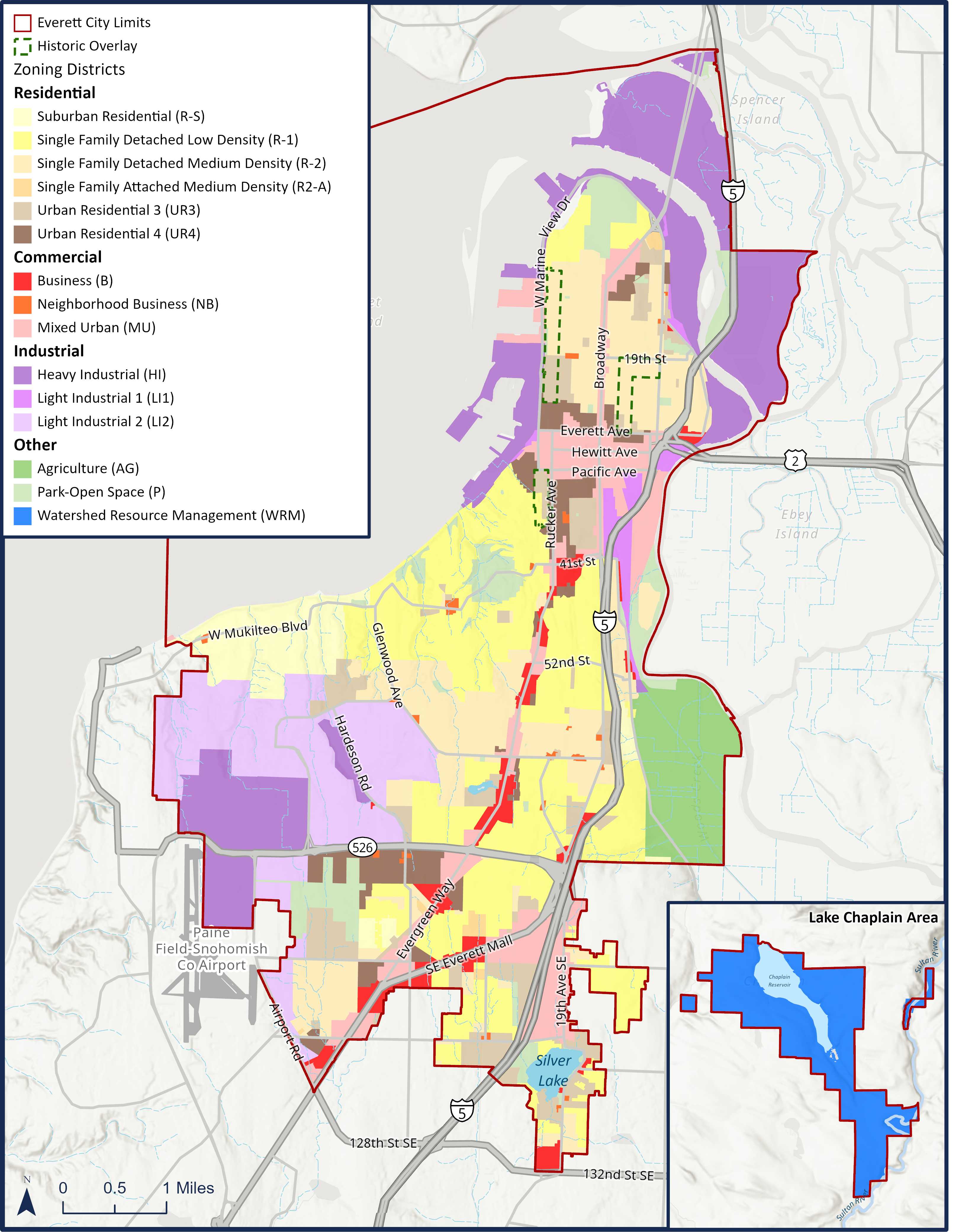
A. Zoning. See Map 3-1 below. The official zoning map of the city is on file with the office of the city clerk.
B. Critical Areas. These maps support the critical area regulations in Chapter 19.37 EMC.
C. Street Designations. See Chapter 19.33 EMC.
D. Gateway Corridor Streets. See Chapter 19.12 EMC.
E. Drive-Through Facility Permitted Locations. See Chapter 19.13 EMC.
F. Overlay Zones.
1. Airport Compatibility. See Chapter 19.17 EMC.
2. Port/Navy Compatibility. See Chapter 19.17 EMC.
3. Historic Resources. See Chapter 19.28 EMC.
G. Building Heights. See Chapter 19.22 EMC.
H. Building Heights—Industrial Waterfront. See Chapter 19.22 EMC.
I. Adult Retail/Mini-Casinos. See Chapter 19.13 EMC.
J. Off-Street Parking Areas in Metro Everett. See Chapter 19.34 EMC.
K. Special Building Setbacks for West Marine View Dr.—23rd St./24th St. See Chapter 19.06 EMC.
L. Shoreline Designations. See shoreline master program.
Map 3-1: Zoning
(Ord. 3774-20 § 5(C) (Exh. 3), 2020.)