19.22.150 Building heights maps.
This section is included in your selections.
Map 22-1: Maximum Building Heights Map*
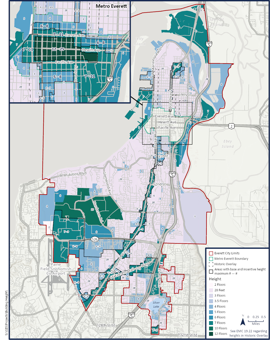
*This building height map at a scale of 1:24,000 or higher can be viewed at the city planning office or in the map gallery of the city’s website.
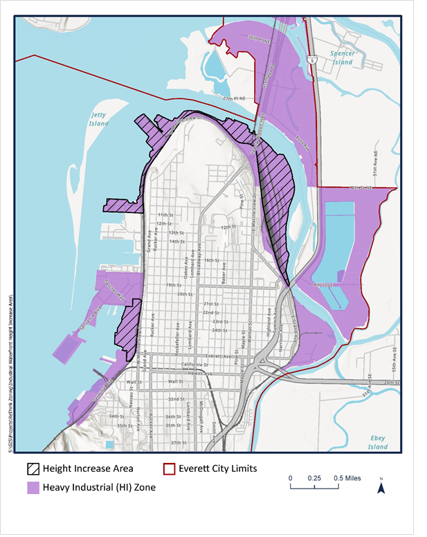
Map 22-2: Industrial Waterfront Height Increase Area
(Ord. 3832-21 § 2 (Exh. 2), 2021; Ord. 3774-20 § 5(K) (Exh. 3), 2020.)